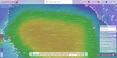
Unfortunately, a Mistral is building up over the Golf of Lion during the week-end which will release its strongest force through the Strait of Bonifacio into the Tyrrhenian Sea Monday and Tuesday. This would mean some 30+ knots of wind and 2-3 m waves directly on our nose which of course is a 'No-Go'.
 |
| Strong winds from W cover the Central Tyrrhenian Sea caused by a Mistral over the Golf of Lion: GFS Forecast model (Copy from www.windfinder.com) |
Looking at different forecast models, we developed a strategy which will take us a bit more of time but nevertheless ensure a fast and safe transfer.
The plan is now to leave Tuesday 25th July morning around 08h00 and first head to NW and change course towards W with the rotating wind staying at the same time within a channel of moderate wind conditions.
 |
| Mistral over the Golf of Lion with jet effect caused by the the Strait of Bonifacio (channel between Corsica and Sardinia). (copy from www.windfinder.com) |
We will carefully watch the forecast models and if needed, adapt our transfer strategy accordingly.
No comments:
Post a Comment